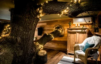
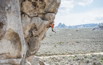
The pleasure of this walk begins the moment you alight from the train at the tiny station in Hever, the path rising from the embankment directly into the wooded countryside. In May the walk is stunning, the path weaving through clouds of cow parsley and an abundance of wild flowers. We saw honeysuckle, herb robert, wild geraniums, buttercups, vetch, red campion, foxgloves, pinky white hawthorn blossom and carpets of bluebells. It's a wonderful walk for foraging, with succulent nettles, dandelions and the heady smell of wild garlic. In September there were plenty of blackberries, autumnal red berries, a Comma butterfly, and - the greatest excitement - a pair of kingfishers flashing past, caught in the sunlight, near the swimming place.
The Medway here is quite narrow and cleaner than the busy waterway that runs through Maidstone - and completely unlike the great tidal river it has become by the time it passes Rochester, Chatham and Gillingham on its way to the Thames. Yet even in these upper reaches the Medway was once important for communications and for powering mills. The channel, which was made navigable up to Tonbridge in the 18th century, was improved up to Leigh in the 19th century, but in recent years the banks have become very overgrown in places.
On the way to the swim the route passes some impressive churches and great houses. Hever Castle, a moated and crenellated sandstone structure dating back to the 13th century, was the home of the Boleyn, Waldegrave and Astor families at various periods. The name Hever is derived from the Saxon 'Heanyfre' meaning 'high edge'. The castle and Italianate gardens are open from April to October but it would be ambitious to combine a full visit with the walk. We would, however, recommend slipping into St Mary's church in Hever, a splendid building dating from the 13th century containing several important brasses, in particular those of Margaret Cheyne (died 1419) and Sir Thomas Bullen (died 1538), father of Anne Boleyn.
Just over halfway the route passes Penshurst Place. Described as 'the grandest and most perfectly preserved example of a fortified manor house in all England', it is a 14th century manor house and gardens. It once belonged to Henry VIII (it was given to Anne of Cleves as part of her divorce settlement) and was then home to the Sidney family from 1552 for 460 years (Sir Philip Sidney was born here). The state rooms are open from the end of March to the beginning of November; the garden is open all year.
Two more churches compete for attention. The church of St John the Baptist in Penshurst is a yellow sandstone building boasting a font unusually painted in bright colours, the Sidney chapel with its painted vaulted ceiling, and many interesting monuments. Thomas Becket was a priest there. A booklet on the history of the village and church are on sale inside.
St Mary's church, Leigh (pronounced 'lie') dates from the 13th century. It underwent some reconstruction in the 1860s, and notable features include a 14th century stained glass, a 16th century brass, an hour-glass stand and Flemish wood carving on the lectern.
Hever to Leigh wild swimming walk, Kent directions
This route follows the Eden Valley Walk (EVW), which is marked on the OS map and is well signposted.
1 Hever village
Upon leaving the station, cross the bridge over the railway and turn left on the path (EVW) by the railway. Pass Bayleaf Hall. On reaching the road, turn left back over the railway. At the T-junction continue straight on (FP signed EVW), passing a lake on your right and a Wealden house on your left. At the road, turn right and then take the first left (signposted Hever Castle), opposite the bus shelter. At the top of the hill you will find the Henry VIII pub and Hever church.
1 mile
2 Hever to Hoath
Pass through the churchyard and continue on this path, which later becomes a track with Park Wood on your left, until you reach Bothy Cottages on your right. Here the path forks right at the gate of one of the cottages. On reaching the road, carry on straight across on the path, crossing a stream and continuing uphill through a wooded area. Cross the bridleway and continue through the woods, through a steep gulley and when the path opens out into a large meadow area, watch for the signpost at the centre of the meadow and bear right to the hamlet of Hill Hoath.
2.5 miles
3 Slips Wood
Turn right at the road junction, taking a path immediately on your left. Bear left at Hill Hoath House and soon right at a path junction. Continue on through a wood (The Slips), crossing a stream. On reaching the B road, turn right then left to stay on the EVW. Walk diagonally across the field and turn left into a minor road (bridleway). Continue straight on to Wat Stock. There is an ideal place for lunch here with a seat round a tree and a lovely view over the Eden valley.
3.5 miles
4 To Penshurst Place
Continue straight on, enjoying the lovely views to your left, finally joining a tarmac road across open country to cross the River Eden. At the main road turn left, then take the first FP sharp right to pass Penshurst Place on your left and reach Penshurst church.
4.75 miles
5 Past Penshurst Place
Pass through the timbered medieval passage (with the inscription 'My flesh also shall rest in hope') and turn left onto the road to enter the grounds of Penshurst Place. At the end of the boundary wall you can turn off to the left to the shop and tea room for a welcome cuppa. Rejoin the path and, after passing a small lake on your left, look out for a squeezer stile on your left. Bearing right, follow this path uphill (look back for a view of Penshurst Place) where you continue straight on, ignoring a path on the left. At a red brick house on the right (marked Killick's Bank on the Explorer map) fork right on the FP through another squeezer stile.
6 miles
6 A swim in the Medway
This takes you down to cross a bridge and another field to the River Medway. Turn left here and look for a place to swim as you approach Ensfield Bridge. There are two spots, close together and near the bridge, opposite the row of poplar trees. You can swim either from a ledge close to the water, or enter the river where the ground dips down to water level. We were told by locals to take care under the bridge itself because there are objects in the river.
6.5 miles
7 Beside the Medway
If you're short of time, the direct route to Leigh station is to turn left along this B road. Otherwise, cross the road and follow the EVW parallel to the river on its right bank, to pass through a beautiful wooded area. Continue on a track through fields, until you reach a path crossing at the beginning of Straight Mile.
7 miles
8 Into Leigh
Leaving the EVW, turn left here on a FP that bears left to cross the river on a Bailey bridge. Keep straight ahead through two fields, going under the railway and up to join a residential road. Continue along this road to reach the green at the far end. Turn left and look out for Crandalls Road on your left. Take this, continuing through a housing area, turning left into Well Close, which emerges onto the main road just before Leigh station. Alternatively, visit Leigh church, visible beyond the green on an eminence overlooking the village. Then turn right (west) out of the church, continue down the High Street to the Fleurs de Lis pub, where you turn left for the station.
7.5 miles
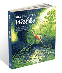 Route by Liz Valentine, Sarah Saunders.
Route reproduced with kind permission from Wild Swimming Walks, book available now for only £14.99 from wildthingspublishing.com


