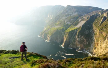
Carros de Foc (Chariots of Fire)
Distance: 62.7km
Difficulty: moderate
Type: alpine
This is a classic high Pyrenees circular route around the Aigüestortes and Estany de Sant Maurici National Park. The route dips into the Val d’Aran, which for centuries was virtually cut off from the rest of Catalonia. Consequently this high mountain valley on the Atlantic side of the Pyrenees has its own Aranese language and proud identity. The landscape boasts spectacular views with an abundance of flora and fauna, and over 200 glacial lakes.
Don’t miss: The UNESCO World Heritage listed Romanesque churches of the Vall de Boí.
Xarxa del Baix Empordà
Distance: 370km
Difficulty: easy
Type: coastal
This network of signed and mapped trails and paths is a fantastic way to explore the Baix Empordà coastal region of the Costa Brava. Encompassing a huge variety of landscapes, from secluded bays to wooded hillsides, coastal plains and low mountain terrain, the trails are designed with walkers of any level and experience in mind.
These paths are ideal for any length of walk, from day trips with the kids, to longer backpacking adventures. Local companies offer guided trips.
Don’t miss: Visit the rocky coves, beaches and coastal paths of the village of Begur.
Sant Pau de Segúries to Lladó
Distance: 75km
Difficulty: moderate
Type: wetland and forest
In the north east of Catalonia, this route takes in the mid-mountain wetland areas of Ripollès, Garrotxa and Alt Empordà, as well as the Mediterranean regions close to the coast. These include the Natural Park of the Volcanic Zone of la Garrotxa, reputed to be the best example of volcanic landscapes in the Iberian Peninsula. All this is complemented by a rich cultural heritage and traditional cuisine. To walk the whole route, set aside a good four days.
Don’t miss: The famous fesols (beans) of Santa Pau or the volcanic cuisine of la Garrotxa.
La Porta del Cel (Heaven’s Gate)
Distance: 59km
Difficulty: tough
Type: alpine
The strenuous but rewarding circular Porta del Cel route explores the Alt Pirineu Natural Park, the biggest natural park in Catalonia, taking in centuries-old trade routes used by the Catalan and Occitan peoples. From the top of Pica d’Estats mountain – at 3,143m the highest peak in Catalonia – on a good day the magnificent mountain-top views stretch all the way from the peaks of la Cerdanya in the east, to the highest peaks of the Sierra Nevada in the west.
Don’t miss: Eat at one of the Associació Gastronòmica de la Xicoia restaurants in Pallars Sobirà.
GR-92 Sender Mediterrani
Distance: 822km
Difficulty: easy
Type: coastal
You don’t have to hike the full 822 km of the GR-92 down as far as Andalucia. But almost any part of the Catalan section of the Gran Recorregut, which itself is some 600km long), is perfect for a pleasant and scenic coastal walk. Stages of the hiking route alternate between coast roads, flat sections that head a little deeper inland and more elevated mountain stretches that reward the extra work it takes to climb them with simply superb views over the Mediterranean.
Don’t miss: Wander around Barcelona – the cosmopolitan and cultured jewel in the Catalan crown.
Estels del Sud (Southern Stars)
Distance: 99.2km
Difficulty: moderate
Type: wetland and forest
The Estels del Sud trail in the south of Catalonia runs through the Els Ports Natural Park, an enormous mass of Mesozoic rock formations broken by a spectacular system of karst formations. In this wild landscape you’ll find a multitude of caves, gorges, cliffs and sinkholes. You’ll need about a week to walk the whole route but if you do, you’ll increase your chances of seeing some of the many species of animals that make it their home, including the elusive Iberian Ibex.
Don’t miss: Visit the River Ebro where you might see some of the enormous catfish it is famous for.


