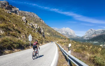
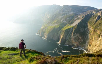
The old joke goes that if you flattened Wales out it would be bigger than England. As most of the population lives in the flat parts, following the road uphill is the best way to escape to the wilderness and explore the mist clad mountain summits, enchanted woodlands, wild seashores and ancient ways. Whether wild camping, pampering yourself in luxury hotels or simply on a day’s adventure, the ‘Lost Lanes’ of Wales offer the perfect way to ride through this tiny country’s varied landscapes.
The Green Desert
BEST FOR WILD CAMPING
A journey into Wales’ wild interior, riding along the Elan valley’s sparkling reservoirs
Start & Finish: Rhayader Distance: 22 miles/35km
Total ascent: 737m
Terrain: Lanes, optional unsurfaced cycle tracks. Moderate.

Starting in the lovely village of Rhayader, follow the climb up to Penrhiw-wen and down to the bridge over the Elan river. From here you can see down the length of Craig Goch, the highest of the four reservoirs that drowned the Elan valley in the 1890s in order to supply water to Birmingham, 76 miles away.
Turn left over the bridge and ride along the western bank of the reservoir. At the first dam, avoid the surfaced road next to the Pen-y-garreg reservoir. Instead, take the off-road cycle path on the far side of the dam. Likewise, the next reservoir, Garreg Ddu, has both a surfaced road and a traffic-free cycle track.
At Caban Coch, the fourth dam, rather than follow National Cycle Route 81 straight down the valley, make a short but intensely scenic detour along the Dulas valley. The last stretch along the Wye valley ends in a final crossing of the Elan river before the last mile to Rhayader.
PUBS & PITSTOPS
Penbont Tearoom, Elan Valley: Lunches and traditional teas by Pen y Garreg Dam. 1 room B&B. 01597 811515
Elan Valley Visitor Centre, Elan Valley: Cafe by Caban Coch dam. Bike hire available. 01597 810880
Elan Cycles, West St. Rhayader: Bike shop and cafe run by former top bike racer Clive Powell. 01597 811343
Seaside Spinning
BEST FOR FAMILIES
An easy, traffic-free ride on Llanelli’s miraculously reborn post-industrial coastline
Start & Finish: Gowerton
Distance: 22 miles/35km
Total ascent: 120m
Terrain: Mostly surfaced cycle track, some unsurfaced and lanes. Easy

Exploring Wales’s south coast around Llanelli, this flat, traffic-free ride is perfect for families. The Millennium Coastal Park extends on the northern shore of the Loughor estuary either side of the town of Llanelli all the way to Pembrey Burrows. From Gowerton, you’ll quickly pick up NCN Route 4 heading west across the River Loughor and along the edge of the Llanelli Wetland Centre, a 450-acre mosaic of lakes, pools, streams and lagoons by the salt marshes and seashore.
West of Burry Port lies Pembrey Burrows, a windblown landscape of Corsican pine and tufty sand dunes. It leads to the sands of Cefn Sidan beach, at eight miles one of Wales’ longest.
The route heads on along a combination of unsurfaced cycle paths and quiet lanes as far as Kidwelly. From here it’s either a 20-minute train journey back to Gowerton (the train also stops at Llanelli and Burry Port), or you can simply turn around and ride back, with the prevailing westerly wind blowing you along like a dream.
PUBS & PITSTOPS
Sosban, North Dock, Llanelli: Chic dockside dining. 01554 270020
The Lighthouse Cafe, Burry Port: Overlooks the harbour where aviatrix Amelia Earhart landed. 07817 945482
Kidwelly B&B, Kidwelly: 01554 890716
Llanelli & Burry Port Cycles, Burry Port: Bike hire available. 01554 835895
A Ruined Ride…
BEST FOR HISTORY
Experience the drama of the lower Wye valley and the bewitching remains of 1,000 years of history
Start & Finish: Chepstow Distance: 29 miles/47km
Total ascent: 898m
Terrain: Lanes. Moderate

This ride follows a trail of ruins, starting at Chepstow, where the Norman cliff-top castle guards a crossing point of the River Wye. From there join the A466 to St Arvans – where a shared-use cycling and walking path runs alongside.
From St Arvans, the route follows the Devaulden Road (NCN Route 31) into the 3,300 acre Chepstow Park Wood. After a right turn towards the Cot, there’s a long, winding descent down the steep-sided Angiddy valley, passing ruins of ironworks that once made this valley Wales’ largest industrial complex in the 1600s.
Tintern Abbey, only the second Cistercian abbey in the British Isles, dominated the valley here for 400 years. From Tintern climb to Trellech, a quiet village but once the largest settlement in medieval Wales. Continuing on through the villages and hamlets that dot the ridge between the Wye and the Usk rivers, the ride reaches Earlswood, before the final downhill to Chepstow.
PUBS & PITSTOPS
Filling Station Cafe, Tintern: Tiny cafe on Tintern’s main road, popular with cyclists. 07770 544592
Kingstone Brewery, Tintern: Microbrewery, top room and woodland glamping. 01291 680111
The Lion Inn, Trelleck Village pub and B&B in an Elizabethan pig cot. 01600 860322
Celtic Coasting
BEST FOR WILD SWIMMING
A Pembrokeshire odyssey from Wales’s ancient cathedral city to the shore of Strumble Head
Start & Finish: St Davids
Distance: 41 miles/66km
Total ascent: 901m
Terrain: Lanes. Challenging

You begin this ride out of St Davids on the A487 towards Solva, soon turning off the main road onto back lanes past a disused Second World War airfield that’s now a nature reserve. The next section is a traverse of the barren but beautiful Pembrokeshire interior initially following the River Solva inland.
Just after Castlemorris the route crosses the Corsydd Llangloffan nature reserve, in the headwaters of the Cleddau Rivers, and exceptionally rich in both flora and fauna. Up ahead rises a ridge crowned at its western end by the Garn Fawr hill fort. Though the road skirts to the side of the summit it’s still quite a climb. At the top you can see all the way to Strumble Head.
This is a ride of two halves and the return leg to St Davids is perhaps the most glorious coastal route in Wales. The sunny, salty, quayside village of Porthgain is well worth the short detour and there are good swimming beaches at Abereiddy.
PUBS & PITSTOPS
The Sound Cafe, St Davids: Great breakfast in this surfer cafe. 01437 721717
Lavendar Cafe, Solva: Arty cafe on Solva’s main street. 01437 721907
The Ship Inn, Trefin: 200-year-old village pub with food. 01348 831445
Cycle Hire, TYF, St Davids: Bike hire in England’s smallest city. 01437 720488
Around the Black Hill
BEST FOR UPS & DOWNS
Take on Wales’ highest road to the idyllic Vale of Ewyas, returning on the English side of the Black Mountains
Start & Finish: Hay-on-Wye Distance: 35 miles/56km
Total ascent: 1018m
Terrain: Lanes. Challenging

Gospel Pass is Wales’s highest paved road and one of the great must-do climbs in British cycling. It’s a full 456 metres in vertical ascent and like a scaled-down version of the famed climbs of the Alps. What follows is more than enough reward for the hard work of the climb: a 12 mile descent down the Vale of Ewyas, one of the most beautiful valleys in Wales, if not the world.
Beyond Llanthony, the route follows the River Honddu to its confluence with the River Monnow. The route rounds the southern flank of Hatterall Hill, a dark wall that rises like an ocean swell above the gentle patchwork of western Herefordshire, and begins the return journey north up the Monnow Valley. It’s a long, steadily uphill ride to the wide plateau of a pass a couple of miles beyond Craswall, and then a long descent down cool, damp Cusop Dingle back into Hay-on-Wye.
PUBS & PITSTOPS
Llanthony Priory Hotel, Llanthony: Cellar pub in the abbey ruins. Bar meals, B&B and camping. 01873 890487
Treats, Llanthony: Cafe, bunkhouse and riverside camping.
Skirrid Mountain Inn, Llanvihangel Crucorney: Macabre village inn. 01873 890258
Drovers Cycles, Hay-on-Wye: Outstanding local bike shop with bike hire also available. 01497 822419
Only the Stones Remain
BEST FOR PUBS
A circuit of the enchanted landscape of North Pembrokeshire’s Preseli massif is a journey back to the Bronze Age
Start & Finish: Fishguard Distance: 39 miles/63km
Total ascent: 1082m
Terrain: Lanes. Challenging

Starting and finishing in the port of Fishguard, this ride begins by following the Afon Gwaun upstream, initially on the B4313 before crossing onto a narrow lane that traces it up the valley. Leaving the Gwaun behind, it’s on to the valley of the Afon Nyfer, climbing gradually to of Crymych.
In the village of Mynachlog-ddu is a collection of standing stones. The lane then snakes its way along the contours of the southern edge of the massif, offering some stunning vistas south across Pembrokeshire’s rolling farmland interior. It’s then a roller-coaster ride through Bernard’s Well and Henry’s Moat, rounding the whale-backed Mynydd Castlebythe. The final climb is just after Puncheston, up the slopes of Mynydd Cilciffeth. It’s then a swooping descent into the Gwaun valley before retracing the route back to Fishguard.
PUBS & PITSTOPS
The Dyffryn Arms, Pontfaen: Bessie’s as it’s known locally, is a front room pub of the old style 01348 881305
Tafarn Sinc, Clynderwen: Eccentric and historic railway pub 01437 532214
Gwaun Valley Brewery, Pontfaen: Microbrewery, tiny campsite and holiday cottage. 01348 881304
Fishguard harbour town has some great backstreet boozers.
 Lost Lanes Wales
36 Glorious Bike Rides in Wales and the English Borders by Jack Thurston
(£14.99, Wild Things Publishing) is available from all good bookshops. For 30% off and free P+P visit wildthingspublishing.com and enter ‘Travel’ as your coupon code.


