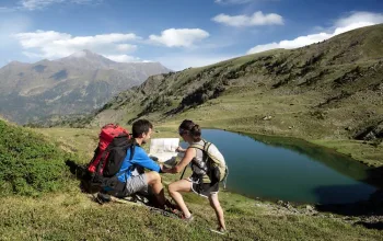
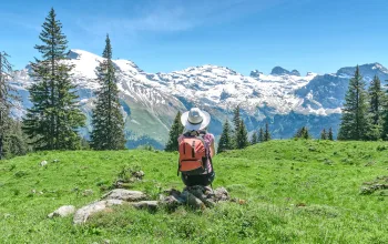
More demanding hikes cover rough terrain where your reward is a stunning panoramic view. Along many of the routes lie refugis: there are 27 of these traditional mountain huts providing shelter and accommodation to hikers, with many completely free. For those who want to rest their head further down the mountain, Andorra’s pretty towns offer a good range of trekker-friendly accommodation. You can also pitch a tent at one of the country’s nine official campsites.
Andorra’s three protected areas each have their own character: in the UNESCO World Heritage-listed Madriu-Perafita-Claror glacial valley, mountain huts, ‘bordas’, paths and the remains of ancient forges are reminders of the mountain resources used by Andorrans for more than 700 years. Comapedrosa Nature Park, is home to Andorra’s highest peak the 2,942m Comapedrosa and its summit offers great views into both neighbouring France and Spain. The third, Sorteny Valley, is home to more than 700 species of flowers and plants.
Five Grand Routes cross the Andorran mountains, exploring most of its hidden corners. Four of these cross the French and Spanish borders, while the Grand Route de Pays encircles the whole country.
Less epic, but no less interesting, Andorra’s seven parishes also have themed walks such as Ordino’s Iron Route, which offers an insight into the country’s cultural heritage, through old iron mines and mills.
Five Top Trails
El Siscaró - Estany de Baix
Distance: 7.2km
Elevation: 500m
Time: 3hrs round trip
Difficulty: Moderate
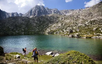
This steady climb takes you to the Siscaró lake at 2,325m. This is one of three lakes accessible from the end of the Incles Valley. The others are the Juclà and the Cabana Sorda. If you’re lucky you’ll see the odd marmot on the screes. A large variety of birds also live there, such as the water pipit, the alpine accentor and the northern wheatear, and mammals such as squirrels and roe deer. One unusual feature of the lake is its reeds, which give the water a different tone of blue and the lake its name (from sesca, meaning reed).
Top tip: Don’t miss tasting a typical Andorran dish, such as Andorran-style trout or soup, in one of the typical mountain restaurants, or bordas.
The Pessons Cirque
Distance: 6km
Elevation: 707m
Time: 5hrs
Difficulty: Medium
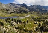
A beautiful walk taking in seven lakes. It starts from the car park of the Grandvalira ski resort in Grau Roig, and offers some wonderful panoramas of lakes and mountains. You might hear the distinctive screeching of the marmots before the path zigzags up to the Pessons mountain pass, offering a fantastic view of all of the lakes together. This hike is possible for anyone to do, but is best tackled by the well-prepared hiker.
Top tip: Don’t miss... a visit to Casa Cristo, which offers you the unique opportunity to see how it was to live in a humble Andorran home from the 19th century to middle of the 20th.
Pic de Comapedrosa
Distance: 15.5km
Elevation: 1,361m
Time: 7hrs
Difficulty: Very difficult
At 2.942m the Comapedrosa is Andorra’s highest peak. The best time to climb it is from the end of May to October, not just because it’s more accessible, but the spring and autumn colours are so striking. The route passes several mountain huts along the way, including the very comfortable Comapedrosa mountain hut. It’s an out and back route, so you come down the same way you went up. As you walk it’s worth reflecting that the mountains of this remote valley were passages for fugitives during the Second World War.
Top tip: Watch out for the magnificent sight of bearded vultures soaring on the thermals.
GRP Andorra: The Grand Route de Pays
Distance: 110km
Elevation: 8,290m
Time: 7 days
Difficulty: Difficult
Where else can you walk around a whole country in a week? The 100km hiking route is divided into seven stages of around 14km each, following hiking routes of varying difficulty and terrain. Overnight stops are at hotels or mountain huts, including Andorra’s largest, the Refuge de L’Illa which has 60 beds and is still free to stay at. The going varies from easy to very hard. Maps of the route can be downloaded from the Visit Andorra website.
Canya de la Rabassa – Pla de Sorteny
Distance: 4.9km
Elevation: 225m
Time: 2hrs
Difficulty: Medium
The Tomb Canya hiking route from la Rabassa to Pla de Sorteny is a delightful way to explore the Sorteny Valley Nature Park. It’s more of a stroll than a hike, and once inside the botanical gardens, there are about 300 specimens of plants, some of which are very rare to the Pyrenees, such as English irises, forget-me-nots and Pyrenean lilies. In season you also get to pick blueberries, raspberries and gooseberries.
Top tip: During July and August don’t miss the Cal Pal sawmill, where there are demonstrations on how to cut wood with hydropower.
Room at the Top
Around Andorra you’ll find 27 mountain huts known as refugis. Some are ‘guarded’ – or staffed – which means you can usually get something to eat as well as sleep. Most are left unattended and while a bit Spartan, are solid, clean and free and have a fireplace with wood. Some have up to 60 beds, but most sleep from 4 to 10.
Watch out, too, for bordas, old rustic huts where people once lived in summer and autumn and where the grass and potato harvests were stored, as well as livestock. Many of these old buildings are now traditional restaurants, where you can enjoy dishes with pork, fowl, vegetables, mushrooms and wild game.
Refugi Borda de Sorteny, situated at 1,965m in the Sorteny Valley Nature Park, is one of the newly renovated mountain huts in Andorra (it’s also a great place to stop for lunch!) It has six 8-bed dormitories and one 10-bed and offers magnificent mountain views. Staying here costs 15 euros a night, with breakfast an extra 7.5 euros. For another 10 euros hosts Carme and Nerea will throw in a picnic lunch for your next day’s hiking.


