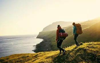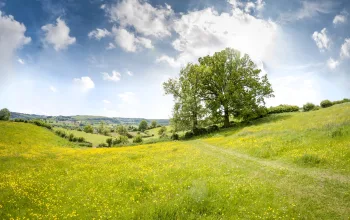

The route starts by crossing a strange mixture of wild and rather forbidding heathland of scrub and gorse, but soon gives way to gentle pastures, small woods and cosy commuter villages. UK heathland is actually very rare and precious, and this heath provides a unique habitat for ground-nesting birds and rare invertebrates among the characteristic plants like bell heather and ling that thrive on these poor, sandy soils. Once thinly populated and devoid of large villages or great houses, the weaving of coarse woollen cloth brought some prosperity to the area along the Wey in the late Middle Ages, but this cottage industry fell victim to competition from London Guilds in the 17th century, leaving high unemployment.
In the 19th century, however, when middle class Londoners began to establish weekend retreats or commuter homes along the new railway lines, the very poverty of the area was an attraction. Low land prices, romantic, uninhabited landscapes and hamlets that looked untouched by industrialisation made it a favoured destination, particularly to those inspired by the Arts and Crafts movement with its nostalgia for a preindustrial England of vernacular architecture and handmade products. The prosperous incomers renovated the crumbling remains of weaving sheds, knocked cottages together, commissioned new houses around existing villages, or arranged them in new 'ancient' villages. Where the work was heavily influenced by Arts and Crafts sensibilities, these 19th and early 20th century buildings are often hard to distinguish from the much older models. Blackheath village, where much of the work was done by the architect Charles Harrison Townsend, is a good example.
Chilworth has a less genteel history, owing its growth to a gunpowder works established in 1625 by the East India Company. The works closed in 1920 but some buildings remain. Wonersh boasts some original early English buildings (of Bargate stone, timber-framed and tile-hung) and good Arts and Crafts architecture, as well as a lot of indifferent later housing. St John the Baptist's church is worth visiting for the beautiful meadow in front and its gateway with an interesting relief, the inspiration and design for which originated with Beatrice E Lock and was developed and carried out by John Hurren, both local residents. The church, which was locked when we visited, was restored in the 18th century and again in 1902, but contains older fragments (part of the north wall is pre-Conquest and the base of the tower is 12th century).
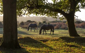
When we did the walk in late April, village gardens were bursting with blossom, banks were covered with the white stars of stitchwort and some of the woods, particularly the one between Bramley and Cateshall, were filled with bluebells and wild garlic. In June, there were foxgloves, buttercups, wild roses and the poisonous hemlock water dropwort. We saw swallows and house martins and heard a garden warbler and a reed bunting. Pairs of Banded Demoiselle damselflies courted along the Wey Navigation and a Small Tortoiseshell butterfly fluttered by in the warm sunshine.
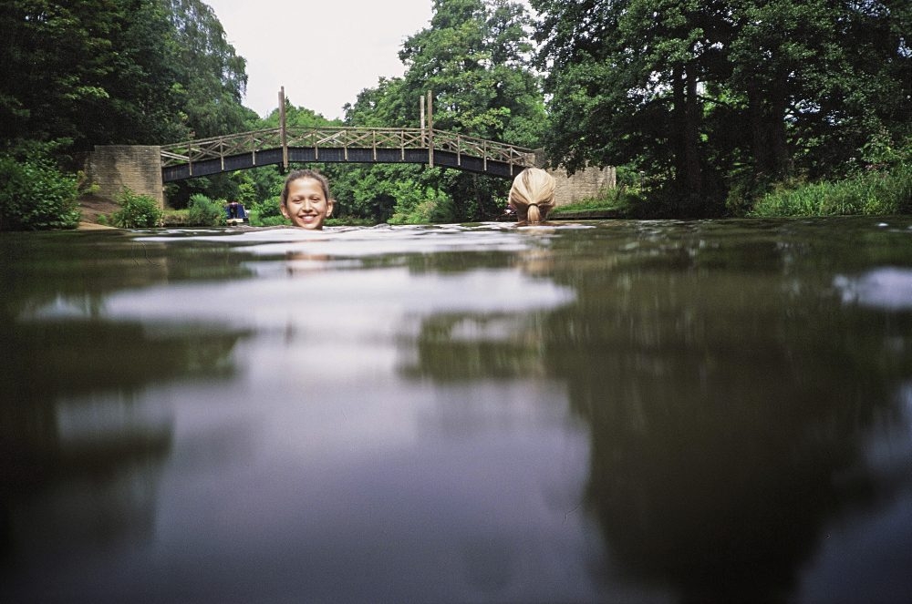
Once the route joins the Wey Navigation it follows the towpath right into Guildford and almost to the station. The Wey was only the second river in England to be turned from wholly unnavigable to wholly navigable. The section from Weybridge to Guildford was opened in 1653 but the extension to Godalming was only completed in 1764. It is now used for leisure by canal barges and canoeists. Swimming is quite well established as a local pastime and two spots in particular seem popular.
The first occurs very soon after reaching the Wey, just beyond the Manor Inn, and is a tiny patch of sandy beach where someone has placed poles, presumably to warn non-swimmers not to go on into deep water. We swam here and it was a pleasant surprise. The weather had turned cold and the water looked grey and uninviting, but as soon as we plunged past the marker poles it became clear why − on warmer days − it is so popular. The water was deep and much cleaner than it appeared from the bank and even in the dull light was full of reflections of trees and sky. There is only a slight current, but one hazard to look out for is the narrowboats, especially those drawn by horses that have limited scope to manoeuvre.
Just after this beach there is a pretty stretch with better cover for changing but less easy access. The next main swimming place is close to Guildford and has a more extensive sandy beach and also a steep sandy bank, which looks as if children love to race down and splash into the water. There are other places too, but less suitable for children. St Catherine's Lock has lovely deep water but lacks access spots, although a little downstream there is a possible entry place.
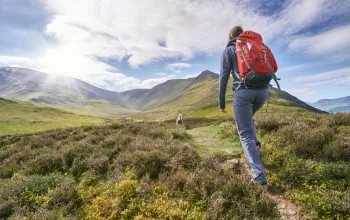
Chilworth to Guildford wild swimming walk directions
1 Chilworth and Blackheath
Turn right out of station along a main road signed to Dorking. Take the first signed footpath (Downs Link) on the right after some houses and follow it uphill. For a time the footpath and a bridleway run parallel. At a junction of paths by Lingwood House, take a right-hand fork on a sandy track over Blackheath, which soon passes a war memorial on the left. On reaching a minor road turn left to the tiny village of Blackheath and continue over a crossroad. (Note the amusing signpost pointing to This way, That way and Somewhere else.)
1 mile
2 To Wonersh
As you leave the village ignore some small unsigned paths to the right but take a signed bridleway on the right (the right-hand fork of two paths). This later joins the Fox Way, is signed by blue-marked posts and descends a steep gully, with a wire fence on your left. You pass Lynes Farm (on the right) at the bottom of the valley. Continue uphill on an enclosed path to reach a cemetery on your left. Cross the track here and continue uphill (SW), bearing left when you meet a fence and a path coming in from the right. Pass Barnett Hill Conference Centre on your right and continue downhill towards Wonersh. At a minor road, turn left and then at the main road turn right. At the next junction bear left on a road signposted to Bramley.

2.5 miles
3 To Bramley
A short way down the road go through a red brick crenellated gateway to the walled church green and the church of St John the Baptist. Note the stone frieze carved by local resident John Hurren in 1953. Return to the road and continue towards Bramley, passing the old Bramley & Wonersh station, to reach a main road.
3 miles
4 Into the Wey Valley
At the main road turn right and then turn left along a lane indicated by a bridleway sign. The lane soon turns into a path that continues ahead between a gate marked private and a driveway. Follow the path uphill and on as it levels out and continues with a golf course on the right. Cross a little road and continue on the bridleway the other side, up a hill with a training track for racehorses on the right and on the left a wood, which in season is full of bluebells. The path is fenced in until shortly after the top of the hill when it soon starts to drop into the Wey valley. At the bottom of the hill, it is crossed by a track. Turn right here downhill, bearing left onto a bridleway at the next junction shortly afterwards, by the driveway to Bunkers Hill Farm. On reaching the river Wey, cross over Trowers Bridge and turn right. After a short distance pass the Manor Inn on the left. After that the river and the path leave houses behind and there are some good places to swim. One is a little sandy beach with a line of poles marking the start of deep water.
5 miles

5 The Wey towpath
From here the route is straightforward. Shortly after the swimming place the Navigation is crossed by a bridge carrying a minor road. After passing Unstead Lock you cross a disused railway line. You pass Stonebridge by a junction of waterways and next cross the A248 at Broadford Bridge.
6.5 miles
6 Approach to Guildford
The next bridge carries the railway from Guildford to Chilworth and beyond. Soon after this is St Catherine's Lock where there are possible but slightly difficult swimming places. There is an easier and popular sandy spot further on where the left bank becomes steep and wooded, just before a footbridge that carries the North Downs Way over the Navigation. Shortly after this the first houses of Guildford appear on the left.
7 miles
7 Guildford
The path continues, reaching a pleasant picnicking meadow between two waterways, at Millmead Lock. It then crosses two bridges, bringing you into the centre of Guildford. Go on past the church. Just before a bridge the station is signed to the left, but it is preferable to ignore this sign and continue along the Navigation to take the next left turning up some steps, which brings you out close to the station.
8 miles
 Route by Margaret Dickinson and Liz Valentine.
Route reproduced with kind permission from Wild Swimming Walks, book available now for only £14.99 from wildthingspublishing.com