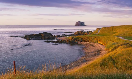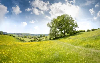
Standing in the sunshine, I look out over a valley of petrified lava. Filling its rutted base is an army of pine trees, lined up like soldiers and marching across it from rugged peak to stony ridge. Above it all an eagle soars, seeking its prey, and in the distance a cloud-cloaked sea twinkles occasionally in the midday sun, the peak of the world’s third largest volcano seemingly floating above it.
This is Europe’s best-kept walking secret, a destination that has year-round warmth, a wide-ranging network of established trails and plenty of peaks to climb. And all this just an easy four-hour flight from the UK.
The Canary Islands get an unfair press. Written off as a flop and drop destination, with nothing more to offer than beaches and bars, too many walkers overlook these rugged islands strung out across the Atlantic Ocean. But this is their loss.
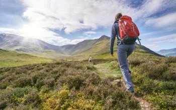
Because walking here is fabulous. I am spending a week bounding through the lunar landscape of Gran Canaria on a Macs Adventure itinerary and up until day four – and that view – I can safely say that I have seen more goats than people. No contest.
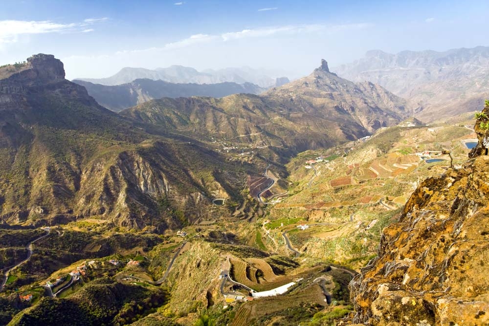
Thanks to its varied landscape, which ranges from Sahara-style sand dunes to lush pine forests, Gran Canaria is sometimes referred to as a continent in miniature. Very miniature – this circular island is just 50 kilometres in diameter. But boy does it pack a lot in, and Macs’ six-walk itinerary is designed to showcase this.
Every day the trail reveals something different – a humid valley of tropical trees, an arid ridge of volcanic rock, a gritty lava field. It also quickly reveals its challenges, throwing down the gauntlet on day two with a steep ascent to an elevation of 1,715 metres. The day begins with a taxi transfer to the hamlet of El Sao – quite literally at the end of the road – but only 483 metres up.
Here my driver points upwards, into misty cloud cover, and smiles. I reply with what would better be described as a grimace and fix my rucksack on my back, readying myself to tackle what I can see will be a tough climb.
Walking in clouds
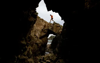
My destination for the day is the remote mountain village of Tejeda, some 16 kilometres – and an estimated seven and a half hour’s walk – away. The path that will take me there runs through the island’s wetter and greener side and I spend my day walking in cloud as I tackle the ridge between Pinos de Galdar and Cruz de Tejeda. Old footpaths run up to the ridge and I grapple with slopes of loose lava rock as I climb.
One steep ascent is followed by another and at times it feels like I will never emerge at the peak. I cross barrancos, water gullies that are now mostly dry at the end of a hot summer, and pass through thick forests, all the time gaining elevation – and knocking back the water. Finally, after eight kilometres of near relentless ascent, I reach the high point of the day’s walk.
Sadly I cannot see my success. Montaña del Capitan is completely cloaked in cloud and I must rely on my route notes to discover that I am looking out towards Altavista ridge and the village of Artenara. I can see neither.
But no matter, I am on the home straight now and find my pace quickening as I race downhill, crossing lava fields where the gravel underfoot is reminiscent of the black sand beaches these islands are better known for.

They should be better known for their mountain villages – of which Tejeda is a fine example. I finally arrive here at dusk, grateful to reach its paved streets and warm lights. This precipitous pre-Hispanic village is to be my base for the next three nights and so I settle in to my apartment at Hotel Fonda de la Tea, celebrating my safe arrival with local cheese and Canarian malvasia wine.
Tejeda is ideally located for walking up to Roque Nublo, Gran Canaria’s most famous peak. The chunky, teetering monolith at its summit (a petrified lava chimney) can be seen from most places on the island – but not today. I peer through the clouds in vain from my balcony and wonder at what else I must have missed seeing today.
Clearing skies
The next morning all is changed. A brilliant blue sky has pushed the clouds aside and as soon as I open my eyes the scenery rushes out to meet me. I am surrounded by volcanic splendour and I cannot wait to start my ascent up to Roque Nublo.
It is like walking on a different island. Gone are the lava fields and misty ridges, replaced instead with swooping valleys and dusty barrancos. From the village a breathtakingly steep path soars up the mountainside and immediately has me slowing – this is not to be a speedy ascent.
But it is to be a beautiful one, the gravel path zigzagging across the mountainside beneath a thick forest of pine trees. I walk on a carpet of pine needles, the only sounds the occasional creak of my hiking boots and the odd rustle in the trees as a bird darts between branches. I spot plenty of tiny Berthelot’s pipits and am sure that the slate-blue flash in the corner of my eye as I round one corner is a rare blue chaffinch.
Stopping for water, I turn to look back and am astonished by how far I have come. Without even noticing, I have climbed several hundred metres and the square white buildings of La Culata, my most recent water stop, look like scattered sugar cubes.
In each direction is yet another jagged volcanic peak, flaunting its violent beauty and sketching out the story of the eruption that formed this epic landscape. And it doesn’t get much more epic than Roque Nublo. This volcanic monolith, whose name means ‘rock in the clouds’ is some 80 metres tall.
This was a sacred place to the island’s indigenous Guanche people – who are believed to have been related to the Berbers – and it is not difficult to imagine why. As I pick my way across the ridged ground at its base, I am struck by how much evidence of the volcanic eruption that formed these islands remains. The ground appears like a rocky riverbed, frozen in time and punctuated by boulders cast aside by its force.
Although this is one of the island’s most popular attractions, few people clamber far over the rocks from the path and I am able to escape the lingering voices of the rock’s other visitors with a few short steps to sit alone on an abandoned boulder and take in the view.
The longer I look at this landscape, the more I can see. Tiny green lizards bolt in and out of the shady spots in the lava flow, kestrels and buzzards wheel overhead and in the far, far distance a string of buildings lines the Atlantic coastline. It takes me a moment to realise that this must be one of the island’s tourist resorts – it looks very far away indeed.
North Star
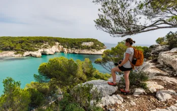
My final two nights on Gran Canaria are spent in La Lechuza, in the greenest part of the island – its north. The walk to La Lechuza from Tejeda has me returning once more to the roof of the island, walking along the ridge of La Cumbre for an hour of endless views. From here I can see out to the Atlantic in all directions, including across to Tenerife’s Teide, Spain’s highest mountain.
Today I’m crossing La Cumbre. This is the island’s watershed and as I descend from its dusty ridge, the landscape changes suddenly from barren south to lusher north. The atmosphere changes too. No longer do I feel up in the clouds all alone. Here there are more signs of man’s taming of the landscape, with agricultural paraphernalia, from drinking troughs to rusty water tanks, lining the path.
The northern half of Gran Canaria, as with many of the Canary Islands, was long the most densely inhabited part of the island, with cooler weather conditions and more fertile land making a life here more viable. It was only the arrival of package tourism that encouraged people to settle in the hot south, where the dry and unforgiving sand dunes of Maspalomas had never before appealed.
My final day has dawned clear and warm and with those clouds from earlier in the week long gone, there is nothing to stop the sun from beating down on my path. The route to La Lechuza takes me along an exposed ridge and I am grateful for the cooling northern breeze. I stop for lunch on a rock and look down into yet another volcanic valley, this one filled not with pine trees but with red-roofed buildings.
I had thought that by the end of a week’s walking through the interior of Gran Canaria, I would be desperate for sun, sand and seafood on the coast. But it turns out that I have fallen in love with the mountains.
On my final day on the island, I reach the coast, visiting the capital of Las Palmas before my flight home. Sitting in the seafront La Marinera restaurant, at the end of Las Palmas’ beachfront I order fresh fish, a mountain of local prawns and papas arrugadas (wrinkly potatoes) served with spicy mojo sauce. It is the best food I have had all week but the view simply can’t match the one from those mountains.