Sponsored content
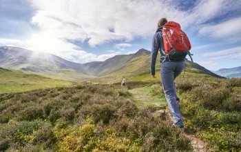
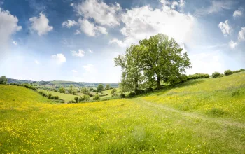
If you're looking for a hiking adventure, the Dubrovnik region has an abundance of beautiful hikes to enjoy, from short walks around medieval city streets - and walls - to challenging routes across mountainous terrain, and nearly always, with breathtaking views of this wonderful stretch of the Adriatic Sea. Whatever your skill or experience you'll find something to help you make the most of such a beautiful country.
Where is Dubrovnik and Neretva County?
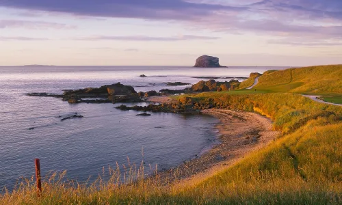
Dubrovnik and Neretva County is Croatia's southernmost region, and consists of two main parts: the southern area, a long, thin length of coastline running between the borders of Montenegro and Bosnia and Herzegovina, including the city of Dubrovnik and surrounding areas, and the northern half, containing the Neretva Delta and more mountainous inland landscapes. The countryside is mainly agricultural and scenically stunning, with a backdrop of mountains descending steeply towards the coast before the terrain flattens out as it nears the sea.
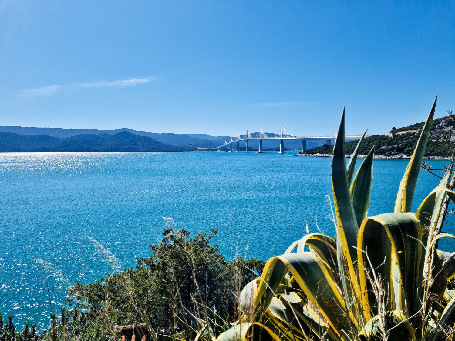
This region embraces not only these mainland areas, but also several beautiful islands such as of Mljet and Korčula and the Pelješac peninsula - virtually an island itself as it's joined to the coast by a slim strip of land.
At the heart of the county is the city of Dubrovnik, a city with a long and tumultuous history, which has been fought over by numerous empires, and, more recently, Daenerys Targaryen's dragons, as the city doubled as the fictional King's Landing in the TV series Games of Thrones.
Croatia's prime tourist season begins around April and ends around the beginning of October, and during that time there are excellent connections via flights from the UK to Dubrovnik airport as well as many other Croatian cities.
Is the Dubrovnik and Neretva County region good for hiking?
If you are visiting during the summer and are planning on heading out for a hike or two it pays to be weather-aware as temperatures can exceed 30C in July and August. Starting early in the morning or later in the afternoon can certainly pay off, especially for shorter walks, and don't forget your suncream, water and sunhat!
There are many hiking routes that criss-cross the region, from leisurely family strolls to challenging multi-day treks, such as the Mljet hiking trail - see below.
Dubrovnik itself is a good place to start your hiking holiday - this red-roofed walled city has enchanted visitors for centuries, and a walking tour of the old town is a must-do of any stay. But it's not all urban hiking around Dubrovnik. Just opposite the city is the verdant island of Lokrum - there are as many as 12 trails to explore here, each taking in the island's must-see destinations including a Benedictine monastery, the botanical gardens, and The Dead Sea Lake.
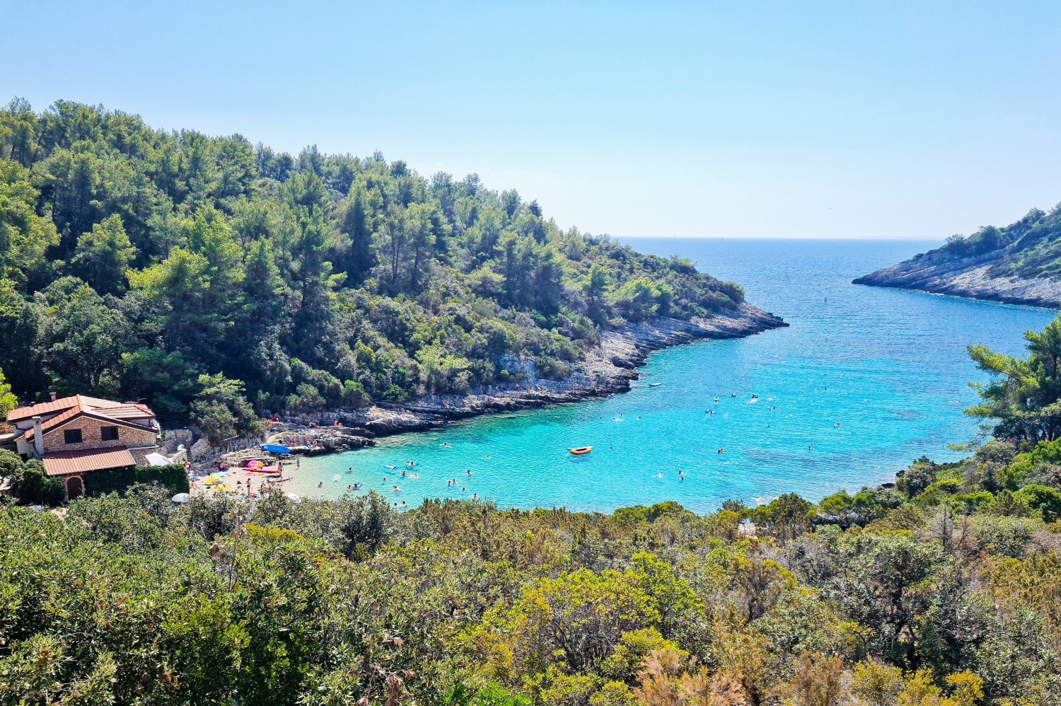
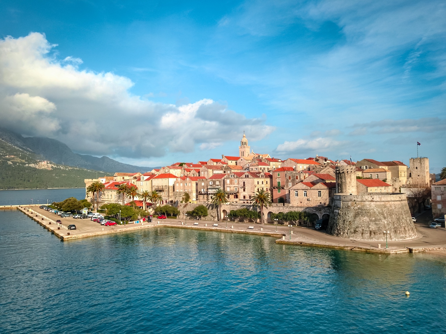
On Korčula there are several hiking trails to help you explore the varied landscape - from terraced olive gardens to fertile fields, from pristine waters in the secluded bays to charming settlements as well as the medieval old town of Korčula - the birthplace of explorer Marco Polo - and one of the best-preserved medieval Mediterranean towns.
The Pelješac peninsula has more hiking trails with a total length of 39 km. Four of them lead to the highest peak of St Elijah 961m above Orebić. The panoramic view from the top is truly spectacular, with the islands of Korčula, Brač, Hvar, Vis, Mljet laid out before you. On clear days, you can even see the outlines of Italy.
The six best hiking routes in Dubrovnik and Neretva County
From easy to tough, from short to long, here are six of the best hikes in the Dubrovnik area.
Hiking up Mt Srd
Distance: 6.1 km return
Duratrion: 2.5-3 hours
Difficulty: Moderate
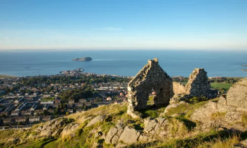
There's nothing like a bit of elevation to get the best views of any landscape, and Dubrovnik has its own handy mountain, rising up behind the city. You can take the cable car up to the peak of Mount Srd, but hiking is the most scenic and rewarding way to experience the views of the beautiful city of Dubrovnik, which gradually unfold and expand as you climb. It's a steep zig-zag climb, and there are a lot of steps, but the panoramic views of the city and the islands are spectacular - especially if you go at sunrise or sunset.
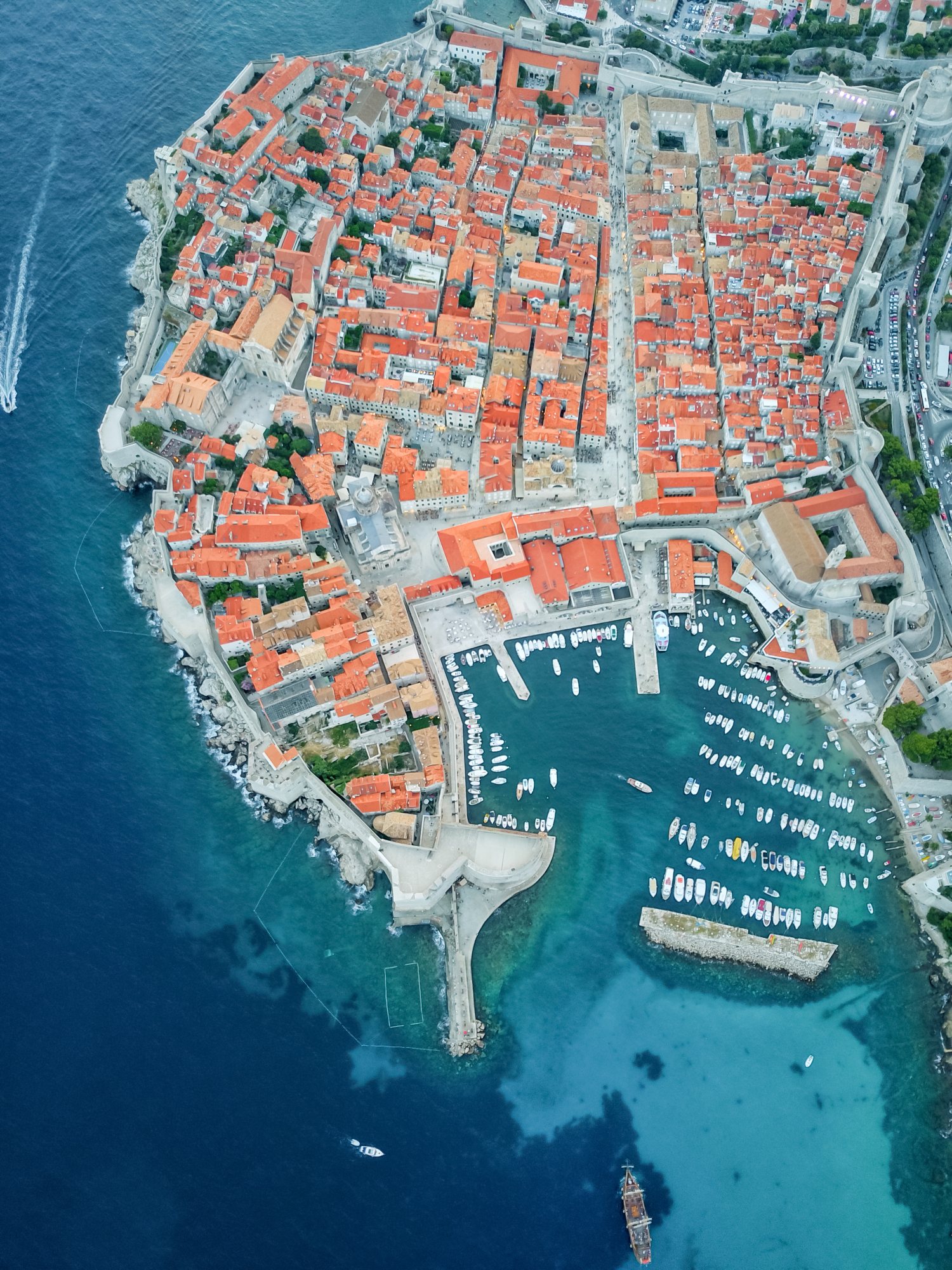
Dubrovnik City Walls
Distance: 2km
Duration: 1.5-2hrs
Difficulty: Easy
There are many different ways to enjoy the city of Dubrovnik on foot, but one must-do is to walk the city's walls, which are steeped in history. The walls are accessible from three points, with the main entrance being at Pile Gate - a sight familiar to Game of Thrones fans, and one of many iconic locations used in the series. (Incidentally if you feel minded to do the 'Walk of Shame' endured by Cersei in the series you'll need to walk the Jesuit Staircase that descends from Gundulić Square to St. Ignatius Church). As you walk the walls you'll enjoy both glorious sea views and vistas across the red rooves. You do have to pay to walk the walls - about £26 - with the money raised used to help maintain this UNESCO World Heritage Site.
The “Ronald Brown” Walking Trail
Distance: 10km
Duration: 4 hrs
Difficulty: Challenging
Konavle is the narrowest strip of Dubrovnik and Neretva County and forms the southernmost part of Croatia. An old agricultural area (mostly wine and olives) it is fast becoming a centre for gastro-tourism, with some of the best domestic restaurants. It's also a popular area for hiking and the Ronald Brown trail is named after a US trade secretary who died in a plane crash in the area in 1996.
The trail begins at the settlement of Gornji Obod, heading towards the settlement of Velji Do (90 min. walk), where there is the restaurant Konavoski Komin, offering traditional meals prepared in the old fashioned way.
From Velji Do, the trail continues on to the cross at the top of Stražišće (30 min. walk – 791 m above sea level), a monument to the crash victims. The summit of Stražišće offers a magnificent panorama of Cavtat, Konavle, Župa and Dubrovnik. Along the trail, you may see many endemic species of plant, in addition to rare and protected animal species.
Korčula Town to Kočje
Distance: 9km (round-trip)
Duration: 2.5hrs
Difficulty: Easy-Moderate
Korčula island is another must-visit location, and there is a network of walking trails to help you discover the landscape and the various villages. We've chosen a hike that starts in Korčula town, as the town itself is fascinating to explore - the layout of the streets and squares is designed in the form of a herringbone to provide safety and comfort to its residents. Within the walls of the Old Town, which is pretty much an open-air museum, visit the Cathedral of St Mark, the Abbey Treasury, the Town Museum, the Marco Polo Interpretation Centre, and the various churches and galleries.
Korčula Town to Kočje is a pretty walk to a small but interesting nature park near the hamlet of Brdo in Zrnovo, which has lots of fascinating rock formations to explore. As you walk the route, you'll also enjoy some spectacular views of the Pelješac channel between Korčula and the mainland spit.
Mount of St Ilija (Elias)
Distance: 5-10km
Duration: 4-6hrs
Difficulty: Tough
The Pelješac peninsula offers some superb hikes in beautiful surroundings that offers spectacular views over the beautiful coastline and Sveti Ilija mountain range. And one of the must-do walks is to the summit of St Illja at 961m.
The walk to the peak takes about two hours and the climb is possible from four starting points: from the village of Urkunići, 200m east of the village of Ruskovici; from the village of Gurići, about 800m north of the Franciscan monastery; from the village of Bilopolje, 1 km west of the Franciscan monastery and from Gornja Nakovana, 6 km northwest of Viganj.
The Mljet Hiking Trail
Distance: 43kms
Duration: 4 days
Difficulty: Moderate/challenging
There are plenty of short and long(er) walking routes on the Island of Mljet, but this is the undoubted highlight of a visit here. It's a dedicated hiking trail that is split into four shorter routes which you can complete in succession, one route a day, with each day stage working out at around 5-7hrs walking time.
The trail features amazing views over the island and across the neighbouring sea channels as well as over Pelješac (the peninsula that is visible from the northern slopes, partly runs parallel with Mljet) and Lastovo, the island that is visible from the southern slopes.
All four routes are clearly marked with distinguished signs at 20 checkpoints along each route. The map of the whole trail is available from Mljet Tourist Information Centre which you can get once you arrive on the island.
Mountain lovers will enjoy the magical views of Mljet's Velebit, the Pelješac peninsula, sunrises from Snježnica near Dubrovnik, and sunsets into the sea behind the mysterious island of Lastovo, which itself has many shorter trails to explore.
For more information about visiting this fantastic area, go to visitdubrovnik.hr